
Map illustration


#EFD1DA


#A6A8AB
#E0B657
#000000
#666666
Map Design
#808285
Interactive Mapping and Design
Interactive Mapping and Design
Geo-Mapping

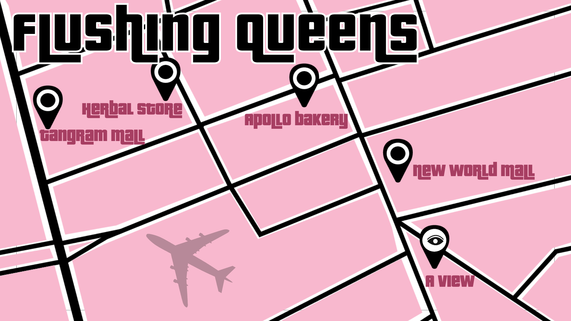
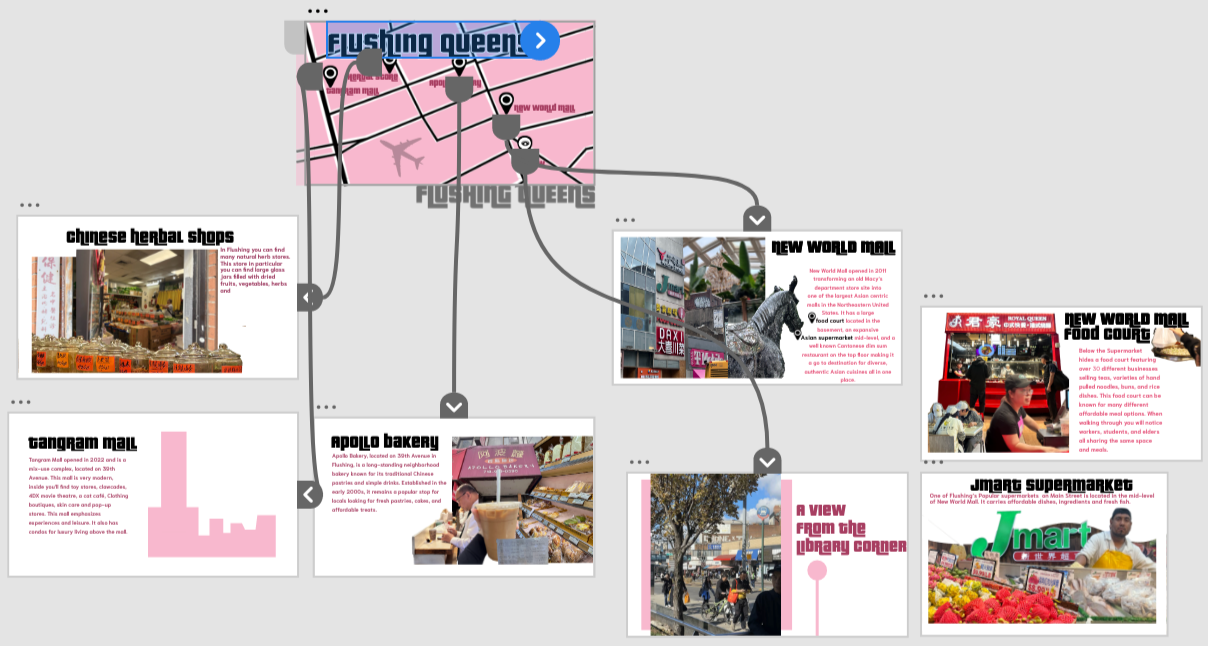
This interactive map was designed with Adobe illustrator and composed on Adobe XD to showcase key locations in Flushing, Queens. Each pin is clickable and leads the user to a dedicated slide with more information about that location, creating an engaging and user-friendly experience. The bold typography, simplified street layout, and high-contrast color palette were used to make the interface visually striking while keeping navigation clear and intuitive.
Geo-Mapping

Prototype
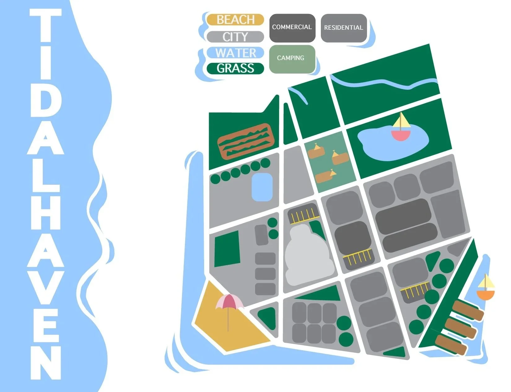
Map illustration

This stylized city map was created in Adobe Illustrator to represent a fictional coastal town using simple shapes, icons, and a clear color system. The design focuses on visual clarity rather than realism, with different zones like water, parks, residential, commercial, and beach areas communicated through consistent colors and symbols. The map demonstrates skills in vector illustration, layout, and information design.
#FEF6A4
#99CAFF
#808285
#FFFFFF
#A73E62
#F8B8CE